
Sovereign operational intelligence
The operating systemfor sovereign African intelligence.
AI-powered solutions for every critical decision.
Discover AirclipseAirclipse connects fragmented data, entities, events, and workflows into one operational picture—so authorised institutions can understand threats and act sooner.
Airclipse is building the decision operating system for sovereign African defence and intelligence.
We help governments, military commands, border agencies, and critical infrastructure operators connect sources, reveal relationships, coordinate response, and maintain control of their operational knowledge.
The objective is not another dashboard. It is an accountable system for understanding reality faster—and carrying that understanding into action.

Airclipse Engine / Operational preview
From fragmented signals to one connected operational reality.
Airclipse Engine links sources, entities, incidents, and decisions—giving analysts and commanders a common picture with traceable evidence.
SatelliteFieldSIGINT
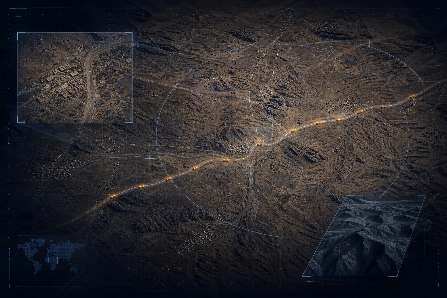
North-east border sector
Cross-border logistics pattern detected
12°02'N · 13°55'E / confidence 89%
Operational workflowDetecting anomalous movement
Four layers. One decision operating system.
01
Data Fabric
Connect satellite, sensor, institutional, operational, field, and open-source data.
02Knowledge Graph
Resolve people, vehicles, organisations, places, events, and the relationships between them.
03Operational Intelligence
Turn connected reality into maps, timelines, alerts, cases, risk, and coordinated workflows.
04AI Command
Ask operational questions in natural language and receive governed, evidence-linked answers.
Start with one mission: border intelligence.
Airclipse Sentinel gives border and security institutions an incident map, geofencing, threat alerts, entity relationships, and pattern detection—built for fragmented sources, uncertain connectivity, and sovereign control.
Explore SentinelBring us the operating question.
Bring us one mission, one operating environment, and the decisions that cannot wait. We will shape the first sovereign intelligence workflow around it.
Get in touch