
Deploy what the mission requires.
Each capability can operate independently or connect into one sovereign intelligence system.
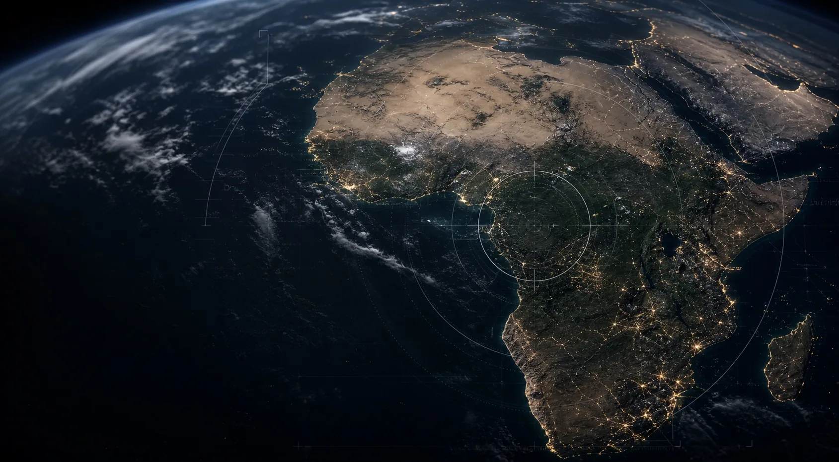
Maintain persistent visibility across borders, corridors, routes, sensitive sites, and contested terrain.
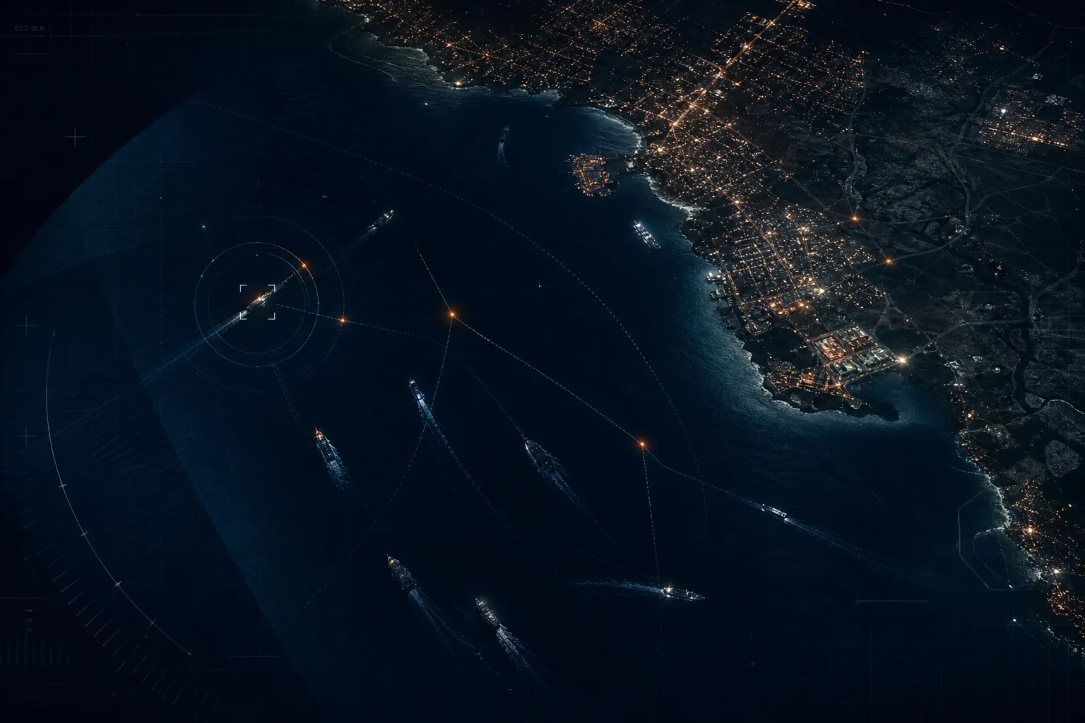
Connect vessel behaviour, coastline activity, ports, offshore assets, and local evidence into one maritime picture.

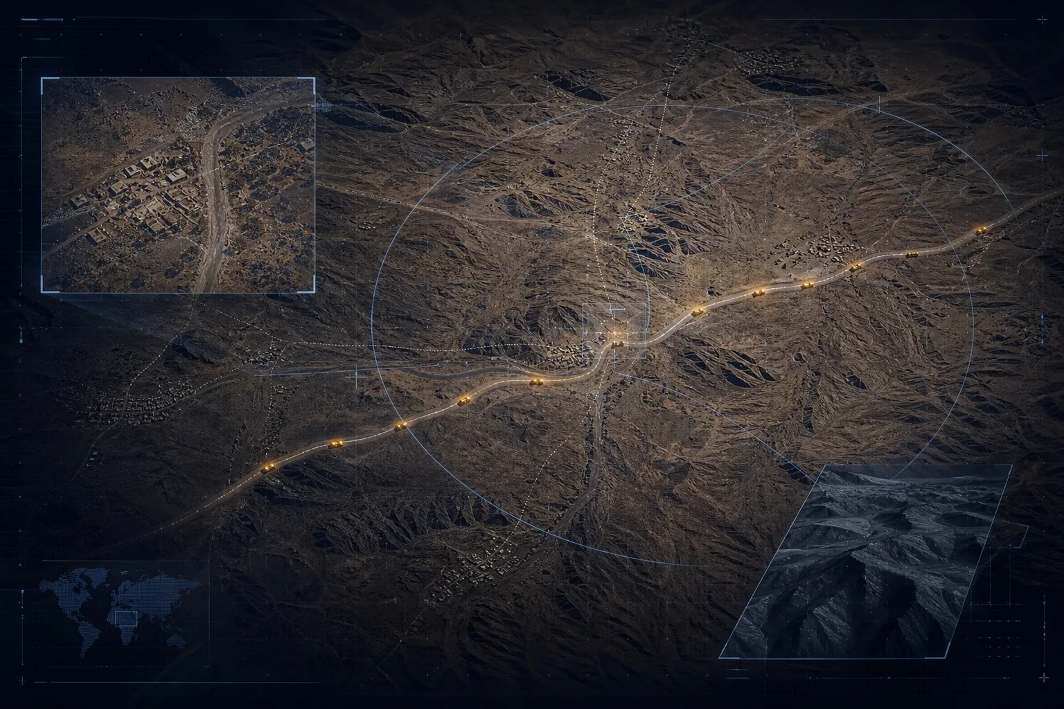
Detect change, encroachment, disruption, and exposure across power, transport, telecoms, and resource corridors.
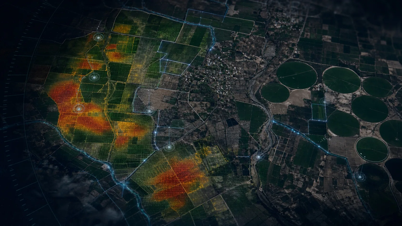
Turn drought, flood, crop stress, land change, and water pressure into operational foresight.
 02
02
Airclipse connects satellite, drone, field, maritime, sensor, and institutional sources across distributed operations. The system correlates time, location, source confidence, history, and mission context—then delivers verified intelligence through alerts, cases, briefs, APIs, and evidence packages.
A repeatable operating loop designed for sovereign deployment, uncertain connectivity, strict jurisdiction, and decisions that cannot wait.
Explore the technology
The strength of the operating picture comes from combining scale with evidence: continental observation, mission-specific analysis, and verification close to the terrain.
Bring us the geography, mission context, approved sources, responsible authority, and consequence of delay. We will shape the right intelligence loop around it.
Discuss a mission