
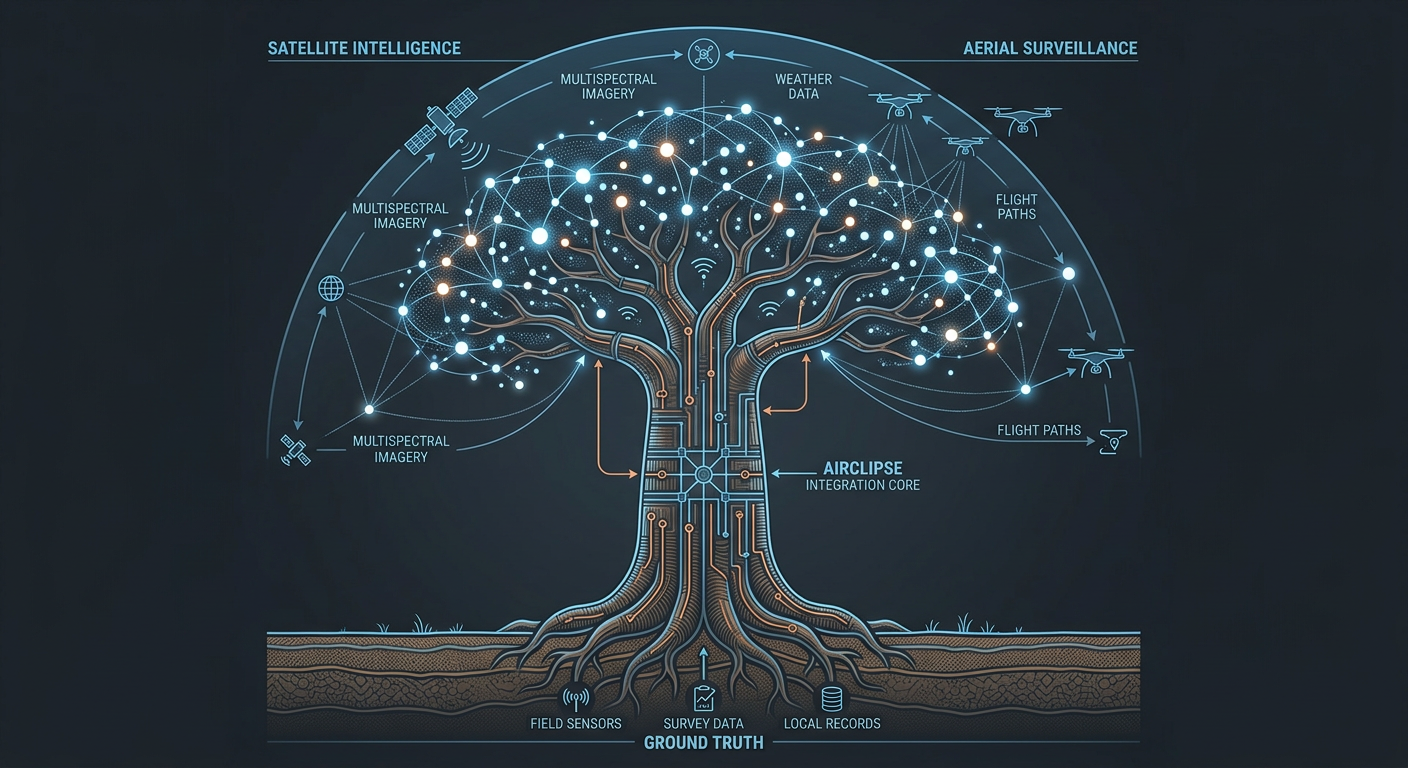
Connect wide-area sources.
Satellite EO, radar, approved commercial feeds, drone streams, field reports, sensors, and institutional records.
A sovereign intelligence layer that connects observation, analysis, verification, and action.
Satellite EO, radar, approved commercial feeds, drone streams, field reports, sensors, and institutional records.
AI-assisted detection, classification, change analysis, spatial correlation, and mission-context enrichment.
Closer sensors, field evidence, maritime context, analyst review, and traceable confidence before escalation.
Alerts, evidence packages, operating views, APIs, cases, and audit trails inside controlled deployment boundaries.
Airclipse is designed for sovereign hosting, intermittent connectivity, role-based access, source traceability, and integration with the systems operators already use.
Request a technical briefing